In this article
At 8:02 a.m. on May 8, 1902, a pyroclastic flow, a cloud of scorching gas and ash, raced down the side of Mount Pelée in Martinique at more than 400 km/h (250 mph). Within seconds, the town of Saint-Pierre was wiped off the map. The death toll is estimated at 28,000. Only two people in the town are said to have survived, one of them a prisoner shielded by the thick walls of his cell. It was the worst volcanic disaster of the 20th century, and it happened on French soil.
Québec has no active volcano, so volcanic risk can seem remote. It is less remote than it looks: potentially active volcanoes exist in British Columbia and Yukon, the French West Indies and Réunion live with this risk, and an eruption on the other side of the world can ground millions of travellers, as it did in 2010. This guide covers the volcanoes that matter to Quebecers and to people in France, alert levels and how to protect yourself from ash.
In short
In short. Canada has five potentially active volcanic zones, all in British Columbia and Yukon. France has several overseas: Mount Pelée in Martinique and La Soufrière in Guadeloupe are both at yellow (vigilance) level, and Piton de la Fournaise on Réunion erupts very often. The most widespread danger for the public is ashfall: stay indoors, wear an N95 or FFP2 mask and goggles, and do not let more than a few centimetres of ash build up on your roof. If an evacuation is ordered, leave without delay.
The dangers of an eruption
A volcano is not just lava. Lava flows usually move slowly enough for people to get out of the way. The deadliest phenomena are much faster:
From the most localized to the most widespread.
- Pyroclastic flowsAvalanches of scorching gas and ash, faster than 400 km/h during the 1902 Pelée eruption. They cannot be outrun: only evacuation ahead of time protects.
- LaharsMud and debris flows that follow valleys for tens of kilometres, at up to 80 km/h according to Natural Resources Canada.
- Lava flowsUsually slow, but they destroy everything in their path: roads, homes, crops.
- Volcanic gasesIrritating or toxic, they collect in low spots and make the air dangerous near the volcano.
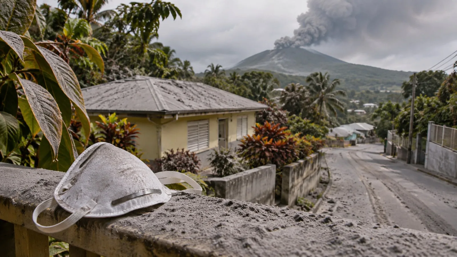
- AshIt can fall hundreds of kilometres away: airway irritation, overloaded roofs, contaminated water and engines, grounded aircraft.
Sources: Natural Resources Canada; USGS; Futura Sciences
In Canada: five zones to watch
Natural Resources Canada identifies five potentially active volcanic zones, all in British Columbia and Yukon: Wrangell, Stikine, Anahim, Wells Gray-Clearwater and Garibaldi. Mount Cayley and Mount Garibaldi are the two volcanoes closest to populated areas: they lie about 150 km (93 mi) from Vancouver, and the town of Squamish alone has about 20,000 residents.
Canada’s last eruption was about 150 years ago, at the Lava Fork volcano in northwestern British Columbia: its lava flow ran 22 km (14 mi) into Alaska and dammed the Blue River. Natural Resources Canada monitors these volcanoes with its regional seismic network and satellite radar interferometry (InSAR), which detects ground deformation to the millimetre. The agency also notes that lahar hazard exists at many stratovolcanoes, even without an eruption.
For Quebecers, these volcanoes are far away. Their most likely impact would be indirect: ash in western airspace, disrupted flights and freight.
In France: overseas volcanoes
According to the French environment ministry’s key figures on natural hazards, about thirty volcanoes are active in the Lesser Antilles. Several directly concern French citizens.
Mount Pelée, Martinique
Active for 127,000 years, Pelée is known for the 1902 eruption that destroyed Saint-Pierre. A second pyroclastic flow killed about 1,000 more people in Morne-Rouge on August 30, 1902. Since late 2020, the volcano has been at yellow (vigilance) level. The scenario scientists consider most likely is a phreatic eruption, caused by water flashing to steam on contact with the heat of magma.
La Soufrière, Guadeloupe
La Soufrière has been active for 9,150 years. It has had 16 recorded magmatic eruptions and six phreatic eruptions since 1635. The most violent of these, in 1976–1977, forced the evacuation of more than 40,000 people for four months. Between early 2017 and late 2021, about 15,500 very low-energy micro-earthquakes were recorded there. According to the May 2026 bulletin of the Guadeloupe volcanological and seismological observatory (OVSG-IPGP), the alert level remains at yellow (vigilance).
In an evacuation, the towns most likely to be affected are Saint-Claude, Basse-Terre, Baillif and Gourbeyre, followed by Trois-Rivières, Vieux-Fort, Vieux-Habitants, Capesterre-Belle-Eau and Bouillante.
Piton de la Fournaise, Réunion
It is one of the most active volcanoes in the world: 83 eruptions between 1979 and 2021, or an average of one eruption day in eight. Its eruptions are mostly effusive, with lava flows, and most occur inside its uninhabited caldera. The IPGP observatory monitors it with 103 sensors at 70 sites.
The Mayotte submarine volcano
Between 2018 and 2021, a new submarine volcano formed about 50 km (31 mi) east of Mayotte. It represents about 6 km³ of magma and rises more than 900 m (2,950 ft) above the seabed. A monitoring network, REVOSIMA, has operated since late 2019.
Value
- Pelée 1902: estimated deaths in Saint-Pierre28,000
- Soufrière 1976–1977: people evacuatedover 40,000
- Soufrière 2017–2021: micro-earthquakes recordedabout 15,500
Sources: Futura Sciences; SDES, Chiffres clés des risques naturels
Volcanic alert levels
In the French West Indies, the ORSEC Volcan plan sets four levels. Here is how Guadeloupe’s environment directorate presents them for La Soufrière:
Only the prefect can decide to move to orange or red.
- No alertMinimal activity, baseline level.
- VigilanceActivity increasing, some parameters changing. The prefect can restrict access to the volcano or water use.
- Pre-alertActivity sharply increased, earthquakes often felt. An eruption is likely in the short term, but not certain.
- AlertMaximum activity: eruption imminent or under way. Evacuation is ordered by decree, in phases, under the mayors.
Source: DEAL Guadeloupe, Sur le risque volcanique en Guadeloupe (2019)
Every resident must follow instructions: evacuating ahead of time is the only protection against pyroclastic flows. If you live in an exposed town, find out now about your zone, your route and your planned shelter.
Volcanoes and travel
For many Quebecers and French people, volcanic risk shows up while travelling. From April 14 to 21, 2010, the eruption of Eyjafjallajökull in Iceland sent ash more than 8 km (5 mi) into the sky. According to Guinness World Records, 313 airports were closed, about 100,000 flights cancelled and some 7 million passengers stranded, at an estimated cost of $2.2 billion to airlines.
Before travelling to a volcanic region (Caribbean, Iceland, Hawaii, Italy, Indonesia, Central America):
- check your government’s travel advice and the volcano’s alert level;
- register with your government as a traveller abroad;
- check what your travel insurance covers if your trip is cancelled because of an eruption;
- keep a few extra days of medication and a filtering mask in your carry-on.
Protecting yourself from ash
The U.S. Geological Survey (USGS) notes that ashfall rarely endangers life directly, except when it is thick enough to collapse roofs. It irritates the eyes and airways and can worsen asthma or other lung diseases. Particles smaller than 10 micrometres are of most concern for vulnerable people.
Before ashfall
The guide from IVHHN, an international network devoted to the health effects of volcanoes, recommends storing:
- dust masks and protective goggles;
- drinking water for at least 72 hours, or 3 to 4 L (about 1 gallon) per person per day;
- food for at least 72 hours;
- plastic sheeting, a battery radio, flashlights and a first aid kit.
When ash is approaching, close doors and windows, put damp towels along the bottom of doors, disconnect gutter downspouts so drains do not clog, and cover electronics. People with chronic bronchitis, emphysema or asthma should stay indoors.
During ashfall
- Stay indoors. Avoid driving: traffic stirs ash back up and roads become slippery. If you must drive, use your headlights and plenty of washer fluid.
- Wear a well-fitting mask. According to USGS, the most effective option for adults is a certified N95 mask, also called P2 or FFP2. Wetting a mask does not improve its filtering.
- Protect your eyes. Wear goggles and remove contact lenses. Long sleeves and pants protect your skin.
- Go easy on children. Avoid strenuous outdoor play while ash is in the air.
The roof
According to the IVHHN guide, most roofs cannot bear more than 10 cm (4 in) of wet ash. Rain makes ash much heavier. You need to clear it before several centimetres build up, but carefully: many people have died falling from their roofs while cleaning. Use a harness if possible, never work alone and do not climb onto a fragile roof.
After ashfall
- Lightly dampen ash before collecting it, without soaking it: wet ash hardens and gets heavier.
- Do not dry-sweep, and do not use leaf blowers or fans, which put particles back into the air. Use a shovel for thick layers.
- Wear your mask throughout the cleanup.
- Protect your water supply: cover tanks and check water before drinking it. The prefect may restrict water use if ash contaminates the network.
- Have your car checked: the guide recommends changing oil and filters much more often than usual after heavy ashfall.
Ash can remain in the environment for months or even years and be stirred up again by the wind.
Your ashfall kit
Frequently asked questions
Are there volcanoes in Québec?
There are no active volcanoes in Québec. Canada’s potentially active volcanic zones are all in British Columbia and Yukon. The Monteregian Hills, including Mount Royal, are very old magma intrusions that pose no eruption risk.
Is a surgical mask enough against ash?
It offers limited protection. USGS recommends a certified, well-fitting N95, P2 or FFP2 mask. If you have nothing else, a damp cloth is better than nothing, but it is no substitute for a proper mask.
My flight was cancelled because of a volcano. Will I be compensated?
An eruption is usually treated as an extraordinary circumstance. Airlines often have to rebook or refund you under the applicable rules, but not necessarily pay compensation. Check your travel insurance before you leave.
Can an eruption be predicted?
Observatories often detect warning signs: earthquakes, ground deformation, changes in gases. That is what allows them to raise the alert level. But the exact date of an eruption cannot be predicted with certainty, which is why evacuation orders must be followed.
Disclaimer. This article is for public information and preparedness. It does not replace bulletins from volcano observatories, prefectoral orders or instructions from authorities. In an emergency, call 911 (Canada) or 112 (France).
Sources
- Natural Resources Canada, Canada’s volcanoes: are they ready to rumble? (in French)
- SDES, Volcanic eruptions, key figures on natural hazards (in French)
- DEAL Guadeloupe, Volcanic risk in Guadeloupe; OVSG-IPGP, May 2026 monthly bulletin (in French)
- Futura Sciences, 120 years ago, the worst volcanic disaster of the 20th century (in French)
- Guinness World Records, Biggest climatic disruption to air travel
- USGS, Volcanic ash: health and Protecting against ash
- IVHHN, Preventive measures before, during and after ashfall (in French)
Go further: the Volcano fact sheet, the Earthquake fact sheet, the emergency equipment builder and the live watch.